Backpacking Maroon Bells
Trip Data
- Photos: Photo gallery
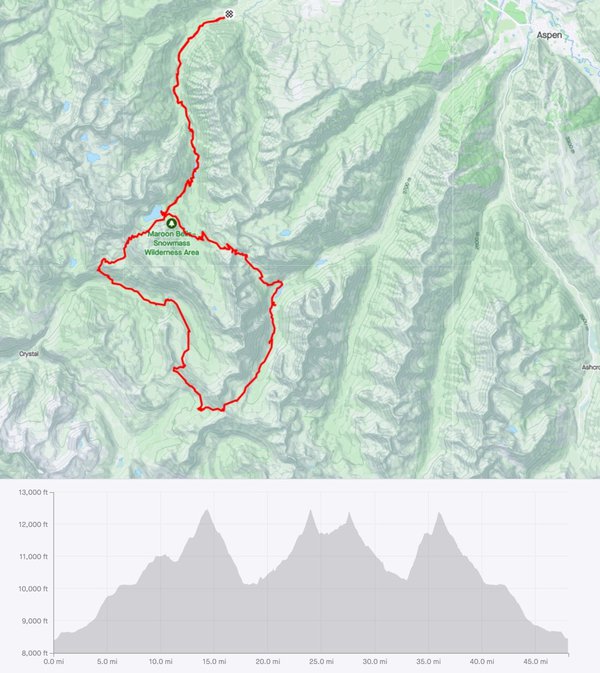
- Route & GPX: Strava
- Hikers: The Lake Below Team - me, Todd, Bill, Rob
- Location: Colorado’s Maroon Bells - Snowmass Wilderness
- Trailhead: Maroon Snowmass Trailhead #1975
- Mileage: 48 miles
- Ascent: 9000 feet (4 passes)
- Elevation: 8500 - 12500 ft
- Date: 27 Sep 2022+
- Duration: 6 days
- Weather: 30s-60s
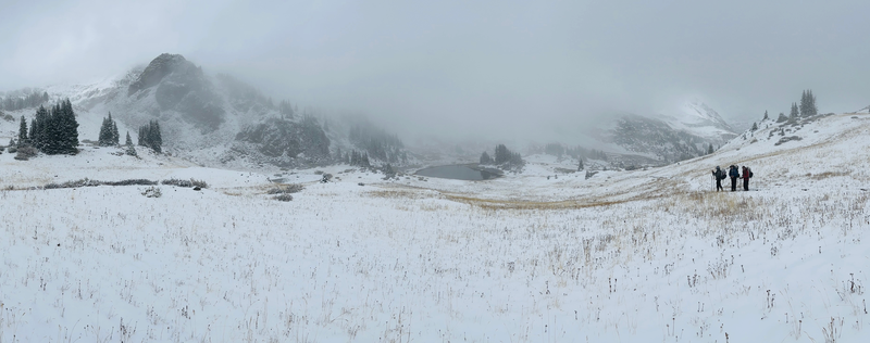
- Conditions: Everything - rain every day, snow, dry, mud
Journal
A few stories from this trip…
Finally
Our first time hiking together since pre-Covid. Man, I missed the West. And my friends.
Fuel, Schmuel
We almost started hiking without fuel. It didn’t quite make the checklist. Fortunately, Bill and/or Todd realized in the evening before our start the next morning that we had no stove fuel. They called every store in Aspen that might have some - everyone was already closed. Bill managed to track down a store new Glenwood Springs - 45 minutes away (one way) who graciously sold him two fuel containers over the phone and left them hidden outside, where Bill and Todd picked them up later that night.
Access
If you read all the online material about hiking in Maroon Bells, what you learn is that, while you do not need a hiking reservation, you do have to take a bus into the Wilderness. And you do need a reservation for that. And the busses are very full, so you have to reserve far in advance… or else you might find yourself a day or two late getting into the wilderness. So I had arranged reservations for us many months before the trip for the 8am bus.
Except I could not quite figure out how the bus was going to get us to our remote trailhead.
At 7:45 that morning, in line, after we had worked our way to the place where you leave your car and get on the bus with a bunch of day hiking tourists, we finally learned from the nice bus reservation lady that nooooooo, you can’t take the bus to our trailhead. For us to get to where we wanted to start hiking, we had to drive. And we could leave our vehicle there at the trailhead. And we could have gone at any time during the day.
Sigh.
So we did that.
The websites still say you have to have a bus reservation to hike from there. But no, you only need a bus if you start at Maroon Lake. Which we’d never do.
Elevation
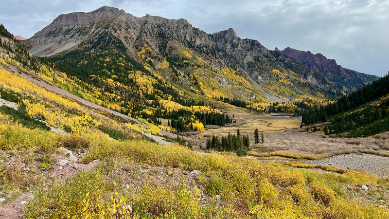
Four huge passes. Amazing views. Altitudes ranging from 9000 feet to 11,500 feet. All of us felt it. The crazy colorful dreams at night. The inability to breathe enough in the last 500 feet of a climb. Impact on speed. It’s a thing.
Dirty
These trails and these campsites were the dirtiest we’ve seen in a national wilderness. We’re taking poor toilet paper hygeine. C’mon Colorado… build pit toilets in the really popular camping areas, and get a little more aggressive with all those morons destroying the sanctity of the wilderness. We saw dozens of hikers, a handful of trailrunners, a horse train, and zero rangers.
Offtrail
We only managed to head offtrail for a few miles, but it was oh so worth it. Next time - fewer trails, more bushwhacking.
Tarp vs. Tent
It rained on us basically every night. So we had the tarp up every night. Sometimes it was a win, letting us sleep where we couldn’t have put a tent. Sometimes it was a huge amount of effort for Bill and Rob, who are knot and tarp geniuses, to get the thing up. I’m amazed at how well it worked in all that weather.
But we kept saying “y’know, a tent would just be easier”.
We’ll see where we end up for the next hike.
Overall
Absolutely gorgeous area. Would go back in a heartbeat. But… would go on trails less traveled.
The Route
The running joke on this trip was that our planned route changed two or three times a day. And it really did.
We started at the north end of Maroon Bells at the Maroon Snowmass Trailhead #1975. Our initial plan was to head south on the Maroon Snowmass Trail to Snowmass Lake, and then to loop clockwise around Capitol Peak, possibly going offtrail over a ridge or two, and then to arrive back at the trailhead from the west.
Alternatively, if we were moving a little slower than we needed for that loop, we would instead go east from Snowmass Lake, head over Buckskin Pass, and then come back north on Maroon Creek trail, returning to the trailhead from the east.
When we started, we weren’t sure which one we were going to do - much depended on the weather, our speed at the high elevation, and mood.
At camp on the first night, Rob and I tossed both options out and suggested that we instead do a loop around the famous Four Passes route, and then to head out past Capitol, since it looked like we were making really good time. The next morning, after most of the party had a really horrible night trying to sleep at 11,000 feet we confirmed that plan, since it would get us into a lower evelation camp on night two.
So, on day two, we went east, over Buckskin Pass, and then headed south, coming pretty close to the main park entrance. We camped at Minnehaha Gulch, which looked like a nice lake on the map, but was really a swampy mess in reality. And… that day was harder than we expected, making me again question our hiking plan…
Day three took us over Maroon and into the very high plateau below Frigid Air pass. That was our best camping of the trip, except for the heavy rain, but again had me a little worried about our plan due to our low mileage. Those passes were hard.
We headed over Frigid Air pass on day four. Where we ended up would determine our path out of the wilderness. If we made good mileage, we’d head up past Little Gem Lake, off trail, into the basin west of Snowmass Mountain. If we were slow, we’d stick with the four passes loop and head back out the way we came in.
It rained on us. And it was cold. And it was tough climbing. When we stopped to camp by the Crystal River, I knew we had to the take the shorter path out. So … we didn’t really know our route until the end of day four.
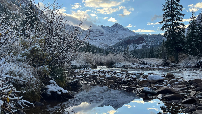
That night, it snowed on us. So we proceeded slowly up and over Trail Rider Pass (in a snowy lightning storm), then down through snow into the mud trails around Snowmass Lake, eventually camping in the brush along Snowmass Creek. It rained on us all night, again…. so the next morning, instead of going offtrail into more snowy passes and staying wet and cold, we elected to head downstream to the car, coming out of the wilderness a day earlier than we planned.


